Showing posts with label D. Sumatera Barat. Show all posts
Sunday, January 24, 2016
Friday, June 10, 2011
Kandi Wildlife Park
The residents are a tiger tail and 3 tail orangutans, additional collections of these animals has a grant from Joyful Loka zoo in Yogyakarta, so holidays in the city Sawahlunto feels more fun with the arrival of the "POND" tiger calls and "Sari, Poltak, and Rambo" oranutan the names. In the near future, a pair of camels and dragons will also supplement this collection Kandi zoo


Sunday, May 22, 2011
Sikuai Island
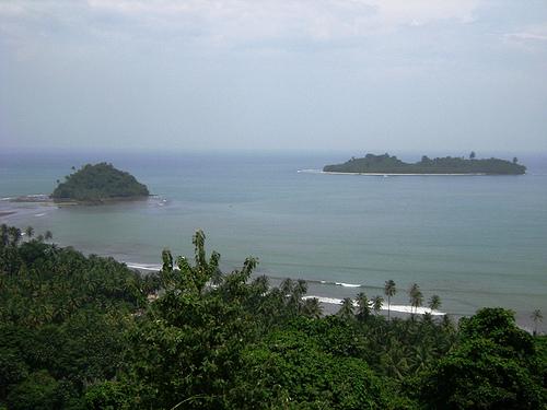
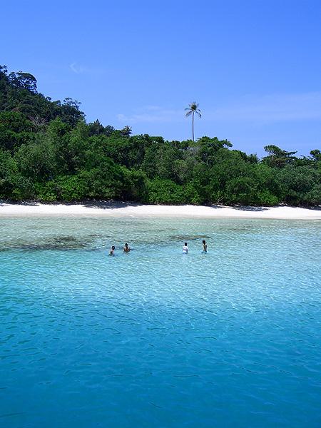
" SIKUAI " is a beautiful private island in West Sumatra, Indonesia. It basks in tropical weather all year long and is perfect for a peaceful getaway from the bustle of the city. Sikuai island is one of the most picturesque destinations in West Sumatra with its untouched forest leading to easily accessible white sand beaches all around the island.
Sikuai has a total area of 44.4 Ha - integrated with 54 rooms, restaurant, meeting room, swimming pool, sunset plaza and jogging track surrounding the island.
The Atmosphere
The island is rich with the nature of tropical rainforest and coral reefs. Relax and unwind at our white sand beach amidst the coconut trees and do not forget to catch the sunset from the Sunset Plaza viewpoint.
Sikuai is where the dream truly becomes reality - you will feel like you are on your own private island.
How To Get to Sikuai Island
From BIM Airport (Minangkabau International Airport - PDG) it is best to take a taxi or any other form of transport and ask them to go to " Dermaga Wisata Bahari in Pelabuhan Muara". Most people at the airport will know where that is in Padang.
It is about a 45 minute drive from the airport to our office at Dermaga Wisata Bahari. Following the check-in guests can relax and wait for the departure at AW Resto. Sikuai island is located 23 km from Padang and takes about an hour to reach by our boats (less than half an hour if using a speedboat).


Saturday, May 21, 2011
Payakumbuh
Payakumbuh is one from seven districts in West Sumatra, Indonesia. Locate at north east of Bukit Tinggi city, it is about 0°10? – 0°17 of south latitude and 100°35? – 100°42′ of east longitude, with area about 80.43 KM square. Payakumbuh city are producing of agriculture product, such as; paddies, palm sugar, cattle and milk for West Sumatra province.
Payakumbuh city divided into three sub district, which are; West Payakumbuh sub district, East Payakumbuh sub district, and North Payakumbuh sub district. There are many tourism destinations in Payakumbuh city.Payakumbuh is also known as galamai city (a traditional food made from coconut palm and flour). It has also a flying duck races, a unique and funny sport, and you can make a city tour by bendi/ a horse cart


Wednesday, May 18, 2011
Pisang Island
Pisang Island is small island is just 2km from Padang but a world apart. The beaches are white sand and the water is usually clear. There is fish life and some nice coral diving from the SW tip. You can walk the beaches and return via the jungle for a modest work-out. Take your own snorkel gear and get there by renting a local outrigger canoe.


Pantai Air Manis
This is about Air Manis beach located on Padangbaycity and Malin Kundang “curse stone”.
Malin Kundang is a famous Minangkabau and Malay folklore and the legendary story is said to be originated here in Padang where the remains of “Batu Malin Kundang” is located.
This folkfore is about a man named Malin Kundang who hails from a poor family. Just like any other Minang men, Malin Kundang decided to travel elsewhere to seek good fortune, leaving behind his old mother. His life changed when he married the daughter of a rich man in Siam. Soon after achieving success and gaining great fortune he sailed back homeward on his own ship to Padang together with his wife and crews.
Upon hearing of Malin Kundang’s return, his mother rushed to the beach to meet her long lost son. Unfortunately, Malin Kundang felt ashamed upon looking at his old and poor mother – he was a rich man with fine clothing and a beautiful wife while his mother was looking ragged and poor as she was. In his undisguised disgust he ignored his mother, refused to greet her and returned to his ship.
Humiliated and heartbroken by her arrogant son’s behavior, his mother fell to her knees in desperation and prayed to God asking that her son be punished for what he did. Soon a terrible storm rose up and Malin Kundang’s ship was wrecked upon the rocks. Realising his mistake and sin for ignoring his mother, the badly injured Malin Kundang tried to get ashore to seek forgiveness from his mother but as he crawled on his hands and knees he was suddenly turned into stone.
Until today, a stone that from a certain angle resembles the figure of a man on his hands and knees with his head seemingly buried in the rock can still be found here in Pantai Air Manis. It is said that Malin Kundang has been forced to stay on the beach forever, begging for forgiveness from his mother. Around this rocky figure barrels and ropes have been carved into the stone to represent the shipwreck washed up on the shore.
The tale of an ungratefull son makes the tranquil Pantai Air Manis a legendary location to visit that may offer some lesson in life.
Friday, May 6, 2011
Bukit Tinggi
Bukit Tinggi (Indonesian for "high hill") is one of the larger cities in West Sumatra, Indonesia, with a population of over 91,000 people and an area of 25.24 km². It is situated in the Minangkabau highlands, 90 km by road from the West Sumatran capital city of Padang. It is located at 0°18′20″S 100°22′9″E / 0.30556°S 100.36917°E / -0.30556; 100.36917, near the volcanoes Mount Singgalang (inactive) and Mount Marapi (still active). At 930 m above sea level, the city has a cool climate with temperatures between 16.1°-24.9°C
History
There are some interesting legends surrounding the foundation and naming of “High Hill” Bukittinggi. The city has its origins in five villages which served as the basis for a marketplace. The city was known as Fort de Kock during colonial times in reference to the Dutch outpost established here in 1825 during the Padri War. The fort was founded by Captain Bauer at the top of Jirek hill and later named after the then Lieutenant Governor-General of the Dutch East Indies, Hendrik Merkus de Kock. The first road connecting the region with the west coast was built between 1833 and 1841 via the Anai Gorge, easing troop movements, cutting the costs of transportation and providing an economic stimulus for the agricultural economy. In 1856 a teacher-training college (Kweekschool) was founded in the city, the first in Sumatra, as part of a policy to provide educational opportunities to the indigenous population. A rail line connecting the city with Payakumbuh and Padang was constructed between 1891 and 1894. During the Japanese occupation of Indonesia in World War II, the city was the headquarters for the Japanese 25th Army, the force which occupied Sumatra. The headquarters was moved to the city in April 1943 from Singapore, and remained until the Japanese surrender in August 1945.
During the Indonesian National Revolution, the city was the headquarters for the Emergency Government of the Republic of Indonesia (PDRI) from December 19, 1948 to July 13, 1949. During the second 'Police Action' Dutch forces invaded and occupied the city on December 22, 1948, having earlier bombed it in preparation. The city was surrendered to Republican officials in December 1949 after the Dutch government recognized Indonesian sovereignty. The city was officially renamed Bukittinggi in 1949, replacing its colonial name. From 1950 until 1957, Bukittinggi was the capital city of a province called Central Sumatra, which encompassed West Sumatra, Riau and Jambi. In February 1958, during a revolt in Sumatra against the Indonesian government, rebels proclaimed the Revolutionary Government of the Republic of Indonesia (PRRI) in Bukittinggi. The Indonesian government had recaptured the town by May the same year.
Bukittinggi is a small town, so these places are within walking distance with each other (15-30 minute walk).
Sianok Canyon (Ngarai Sianok)and the Japanese Caves (Lubang Japang), a network of underground bunkers and tunnels built by the Japanese during World War II. There is a two-story observation tower that overlooks the Sianok Canyon. During dusk you can observe megabats flying from the gorges to the forest in order to feed from the fruits on the trees. This is also a good place to get in contact with guides for tours such as to Lake Maninjau (see below) or jungle/hiking trips through the Canyon.
Fort de Kock. A fort built by the Dutch (nothing is left, only a water reservoir is on top of the hill) and Bundo Kanduang Park. The park includes a replica Rumah Gadang (traditional house), used as a museum of Minangkabau culture (many curiosities, such as stuffed animals with two heads and six legs, model houses and traditional dresses, , and a zoo with a few very sad Orang Utans, a few expired species which are still rotting in their cages, two obese bears - not exactly a example in modern animal keeping. The Dutch hilltop outpost Fort de Kock is connected to the zoo by the Limpapeh pedestrian overpass.
House of Bung Hatta (the first Vice President of Indonesia).
Clock Tower (Jam Gadang)
There are horse carriages waiting around the Jam Gadang area. Please be cautioned that the rides are very costly, therefore please ask for their rates first.


Monday, May 2, 2011
Lembah Anai
Fort De Kock Castle
This fortress was built in the peak in the Bukittinggi city in 1825 when the people's opposition happening that was led by Mr I Imam the Protruberance and the Nan Salapan Tiger against the Netherlands.
Around this Fortress still could be seen by us the old gun the period of the XIX Masehi age. This wide place was decorated with the garden as the place of the height witnessed, the Sianok Gorge and surrounding hills were gotten the old gun and the fortress building. This was the best place in Bukittinggi witnessed Sunset.
Ngarai Sianok
The Sianok gorge was located in the Centre of the Bukittinggi city, lie alongside from South Nagari Koto Gadang continue to to the north, Nagari Sianok Enam Suku and ended in Palupuh in a long manner 15 km, the depth 100 metre and wide 200 metre.
The Sianok gorge or this Pendiam Valley was a beautiful, green and fertile valley, was displayed by him flowed a winding tributary investigated gaps tebing that coloured-warni with the Mount Merapi background and Singgalang that menghijau was nature that enchanted. The uniqueness of this Gorge was easy to be achieved, a Gorge in the centre of the city that was not found in other cities in the world. Beauty of the Sianok Gorge of nature that enchanted that always was immortalised by tourists by taking photographs as well as as the imagination for the painters.
Subscribe to:
Posts (Atom)